
DEFIANT
Drivers and Effects of Fluctuations in Sea Ice in the Antarctic

The main goals of this project are to determine the causes of Antarctic sea ice variability, and to improve climate modelling capabilities.
Despite global warming, Antarctic sea ice expanded during most of the first four decades of satellite observations. However, in 2016, an alarming change occurred as the Antarctic sea ice area plummeted, reaching levels far outside the range of previously observed variability. Neither the increasing trend nor the rapid decline are authentically simulated by climate models, casting doubt on their ability to represent associated processes including Southern Ocean heat and carbon uptake, melting of the Antarctic Ice Sheet, and many other aspects of the Southern Hemisphere climate.
Climate models play a crucial role in understanding and predicting the impacts of global warming. These models simulate various processes, including Southern Ocean heat and carbon uptake, melting of the Antarctic Ice Sheet, and other aspects of the Southern Hemisphere climate. However, the inability of these models to accurately capture the observed increasing trend in Antarctic sea ice or the subsequent rapid decline casts doubt on their effectiveness in representing these crucial phenomena.
Efforts are underway to improve climate models and enhance their ability to replicate the observed changes in Antarctic sea ice. Researchers are working on refining their understanding of the underlying processes responsible for the expansion and contraction of sea ice in this region. By gaining a more nuanced comprehension of these mechanisms, scientists hope to address the limitations of current models and improve their efficacy in predicting the future behavior of Antarctic sea ice.
There are 5 main objectives of this project:
- Identify the atmospheric and oceanic processes that caused the 2016 rapid decline in Antarctic sea ice.
- Improve the physical representation of the processes responsible for historical changes in Antarctic ice, ocean, and atmosphere models, including the decadal growth and recent collapse.
- Identify the short-term (<10 years) effect of the sudden decrease in Antarctic sea ice on global oceanic circulation patterns using model simulations with improved physics.
- Combine historical observations and model predictions to assess whether enhanced variability and loss of sea ice constitute a new normal and examine the implications for exchange and redistribution of heat and CO2 over decadal timescales.
- Synthesize advances from above objerctives, disseminate knowledge gained and deliver new climate modelling tools.
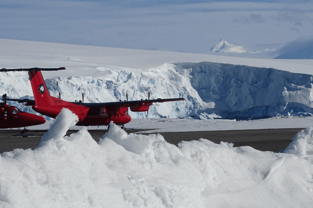
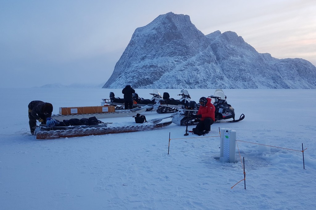
The DEFIANT project brings together UK and international experts in polar marine and atmospheric science as well as climate modelling. DEFIANT is steadily dismantling fundamental knowledge gaps, through a combination of year-round field work observing the Antarctic air-sea-ice system, satellite remote sensing, and model analysis.
The project will gather new observational data from a number of in-situ and airborne field campaigns in the Weddell Sea to develop robust, validated, estimates of sea ice thickness from satellite data. Atmosphere, sea ice and ocean observations will be used to calibrate and test model physics linked to Antarctic sea ice variability. In particular, researchers will constrain fluxes of momentum/heat/salt/moisture between air/ice/ocean, and ocean turbulence, in sea ice (SI3) and ocean (NEMO) models, and in a coupled climate model (GC5). Lastly, DEFIANT’s scope will be extended to cover longer timescales and broader geographical regions. This will be accomplished using an interdisciplinary approach, combining CMIP6 analysis, new simulations with the NEMO-SI3 and HadGEM3-GC5 models, and analysis of observations and state estimates.
For more information, visit the DEFIANT homepage.
Sikuttiaq
“Good ice” | Sea ice travel safety and sea ice monitoring in Inuit Nunangat

The main goals of this project are to monitor changes in Arctic sea ice, map sea ice hazards, and facilitate safe ice travel for Inuit communities.
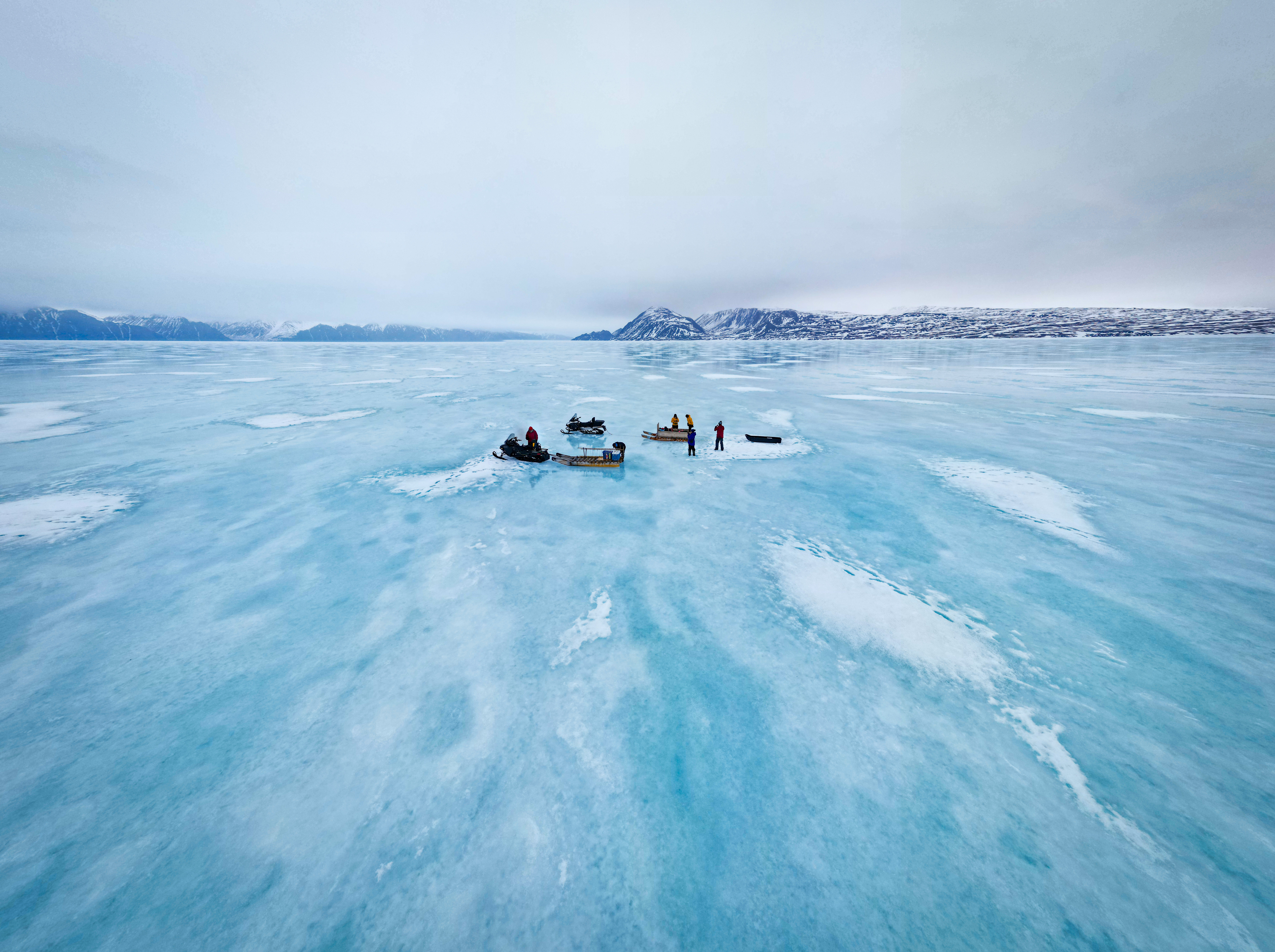
Sea-ice roughness, thickness, and slush are key characteristics that not only determine the safety and efficiency of ice travel for the Inuit community, but also hold significant implications for their overall well-being. The traditional reliance on sea ice as a means of transportation and access to vital resources has long been deeply ingrained within Inuit culture. Smooth and thick sea ice has historically facilitated the movement of people and goods, enabling Inuit communities to connect, trade, and engage in significant cultural activities such as hunting, fishing, and gathering. In contrast, rough and thin ice, coupled with the increased presence of slush due to fluctuating temperatures, poses significant challenges and risks to these essential activities.
Moreover, changing ice conditions have a direct impact on the availability of food sources for Inuit. This threatens the food security of Inuit communities and their ability to maintain their traditional dietary practices and cultural identity. The negative effects of these changes extend beyond the physical realm and significantly impact the mental well-being of the Inuit people. Sea ice holds immense cultural significance, serving as a source of knowledge, connection to nature, and a symbol of cultural identity. The loss of reliable sea ice conditions and the associated disruption to traditional activities can contribute to feelings of anxiety, frustration, and a sense of disconnection from their ancestral lands and practices.
Addressing the challenges posed by the changing sea ice characteristics requires a multi-faceted approach that combines scientific research, traditional knowledge, and collective action. Efforts to mitigate climate change, implement adaptation strategies, and support indigenous-led initiatives are crucial for ensuring the preservation of sea-ice-dependent cultures and the well-being of Inuit communities.
Approach:
SmartICE’s Inuit-led project team will combine satellite data (optical and micro-wave frequencies), state-of-the-art uncrewed airborne vehicles (UAVs, or drones), and most importantly Inuit Qaujimajatuqangit (Inuit knowledge, values, and worldview) to co-produce new information on sea ice roughness, snow roughness, and slush for community ice travel safety maps (see SmartICE.org).
The production of these maps will be piloted in partner communities and eventually expanded across Inuit Nunangat. This project will be grounded in Inuit Qaujimajatuqangit and include a co-designed Inuit training program for UAV-based sea-ice monitoring to augment the mature environmental data collection developed by SmartICE.
For more information visit the Sikuttiaq project page.
